The municipality of San Bartolomé; he is located in the center of the island, on the west side of Mina Mountain. It has an area of 40.89 km2 and the Lanzarote airport is located there.
To the north, the jable territory, which runs from Famara to the southern beaches, favors crops that take advantage of the nutrients provided by the sea. Its link with the cultivation of the land, led to César Manrique to honor the work of the island peasant, with the Monumento al Campesino, which together with the House Museum collects in its rooms rustic tools, handicrafts and other traditional toolsof the ancient inhabitants.
Towards the south lies the prelude to La Geria, dotted with small hamlets that contrast with the urban center of San Bartolomé. and
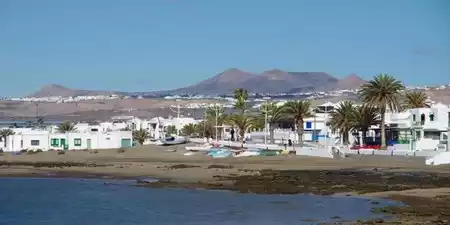
The only outlet to the sea in the municipality is Playa Honda, a residential area with all the comforts and services, which has become the second most populous in Lanzarote behind its capital, Arrecife.
San Bartolomé, as corroborated by certain archaeological sites, was the most important town of the ancient natives of the island, Los Majos, before the conquest of Lanzarote.</p >
The ancient Ajei of the aborigines links its history to the jable and to the Guerra family.
Don Baltasar Perdomo, a local priest, explains to us how the flying sand caused the town to change location, since many of its houses, such as those of Messrs. Carrasco, González, Ferrer and Tejera they were touched by the sands that ruined them.
The other link in local history is the Guerra family, specifically since the second half of the 18th century, with Major Guerra, Don Francisco Guerra Clavijo y Perdomo, Lieutenant Colonel and Chief of the Provincial Militia Regiment of Lanzarote, Mayor Sheriff and Dean of the City Council of San Bartolomé. stopped authority in government functions, exercised the administration of justice throughout the island. arrived to establish the jurisdiction of War, by which it was allowed to charge some taxes.
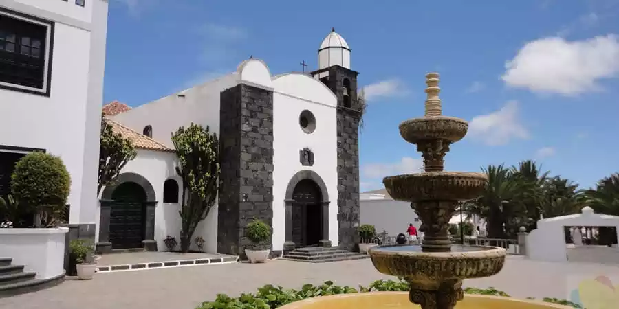
The founder of the church of San Bartolomé it was Don Cayetano Guerra Clavijo y Perdomo. On April 20, 1787, he and his brother Francisco requested the erection of the parish, together with that of Tías. It began its journey as such a parish on April 2, 1796.
The descendants of the Guerra family played prominent roles in major historical events such as the so-called Little War.
San Bartolomé in the first third of the 19th century.
It occupies a central position within the island, opening towards the sea to the south. Its limits are not going to follow concrete accidents, but suppose more or less straight lines. Thus, to the east is Arrecife and Teguise. To the north, an undulating line marks the limits with the latter municipality and with Tinajo. To the south, another almost straight line marks the division with Tías, which rests on the Bermeja mountain and continues to Guasimeta beach, dividing the current airport facilities.
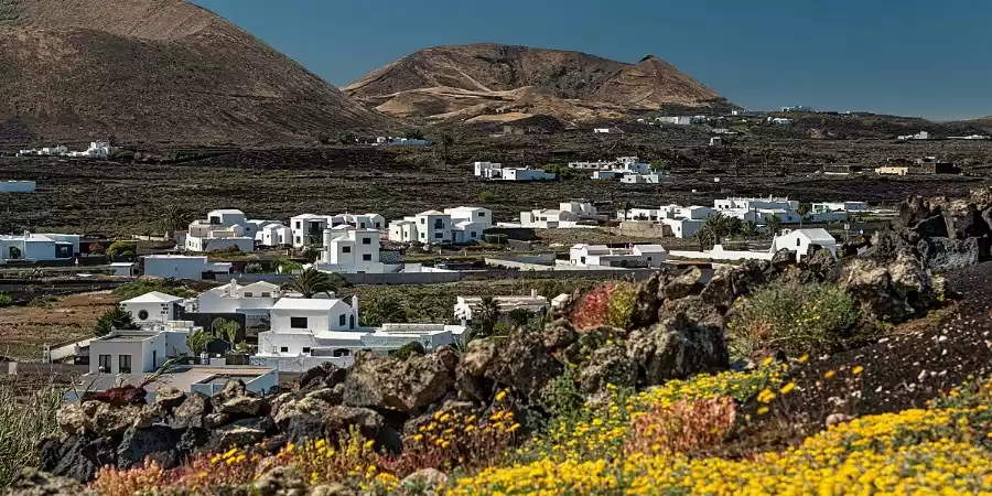
It represents an area with few outstanding altitudes, where some isolated volcanic cones stand out, although they present a relief with several differentiated elements.
On the one hand, there are outcrops of the first volcanic series that gave rise to the formation of the island. In addition, buildings corresponding to later series (La Mina, Guatisea), and even a sector occupied by the historical lavas of Timanfaya (1730-36).
These lavas can leave surrounding areas not affected by the eruptions, the so-called islets. To finish drawing this space, the jable is present in large sectors, since the municipality is located in an area of passage of these sands moved by the wind, from the northwest to the southeast of the island.
The low altitude determines climatic conditions marked by aridity, although a good part of the term is favored by being open to the trade winds. The scarce amounts of moisture are used by an agriculture that is fully integrated into the environment: jable, sanded and badlands.
Although the traditional basis of the municipality's economy has been agriculture, however, its proximity to the island capital has led to a significant change in the activity of its inhabitants, who have moved into the service sector, especially construction. ;ny tourism.
In the Jable area, the land is dedicated to the production of onions, sweet potatoes and legumes. The vine predominates in the lava layers of more recent formation, leaving traces of its former occupation by the fig trees.
Livestock is relatively important. The herds of goats, which produce an excellent cheese, are also cared for by the recent lava fields, as well as in its surroundings, in the northern part of the municipal area.
Despite this, of the available agricultural land, only a scant 30% is cultivated, of which, in turn, vineyards occupy more than 40% and onions almost 30%. .
The cultivation techniques developed by the farmers of Lanzarote represent an art that knows how to make the most of the adverse conditions offered by the environment. Both the sanded ones, whether natural or artificial, as well as the crops in jable and in cracks, represent referents of great cultural value. Only in this way is it possible to extract from this burned land, fruits of recognized value, in the case of grapes, which provide a wine of just fame.
In the artisanal aspect, palm works and rosettes and lace are highlighted.
Musical folklore is represented by the veteran group Ajei.
It is interesting to cite first the so-called Zonzamas Palace due to its outstanding archaeological value.
Then we have to refer to the parish church, in which carvings of great interest are preserved, such as that of San Amaro that hides the original owner of the parish, as well as that of San Amaro. like a crucified.
As civil buildings, the palace house of Mayor Guerra appears in the first place, as well as the such as the so-called Casa Ajei, a stately farm building, also dating from the 18th century.
Finally, the Monumento al Campesino, the work of the recently deceased César Manrique.
The northwest sector of the municipality is within the area cataloged as La Geria Natural Park. Here, both the crops in sanded areas and in cracks appear. In the first of the cases, the insulating and water-capturing capacity of the sand (name given to the picón on the island) is used to plant in these extensions, covered by the aerial projection materials emitted in the eruptions of the eighteenth century. In the second, the surface cover of the lava flows is broken, to reach the fossil soil that has been buried. In both cases, the main crops are vines and, to a lesser extent, fig trees and others.
On the coast, the narrow coastal strip features Guasimeta beach and Playa Honda.
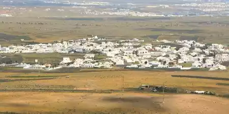
The municipality of San Bartolomé is made up of seven population centers, each with its own unique character and charm. These include the main town of San Bartolomé, as well as Playa Honda, Güime, El Islote, Mozaga, Montaña Blanca, and La Florida.
From the lively coastal life of Playa Honda to the rural calm of La Florida or the volcanic beauty surrounding El Islote, the towns of San Bartolomé offer a rich and diverse experience for anyone looking to discover the heart of Lanzarote.


La Florida is a small town belonging to the municipality of San Bartolomé, located in the center of the island.

Located in the center of Lanzaro te, gets its name from the mountain to the south, the White Mountain, an ancient volcano.

San Bartolomé is a town located on the island of Lanzarote. It stands out for its rich aboriginal and colonizing history, its agricultural importance and its current tourist development.
Promoción y turismo en internet